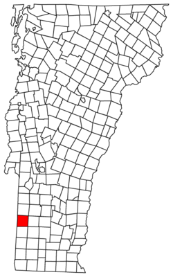
Sandgate, Vermont
From Wikipedia, the free encyclopedia
| Sandgate, Vermont | |
|---|---|
| Town | |
 Sandgate, Vermont | |
| Location in the United States | |
| Coordinates: 43°9′13″N 73°11′21″WCoordinates: 43°9′13″N 73°11′21″W | |
| Country | United States |
| State | Vermont |
| County | Bennington |
| Area | |
| • Total | 42.2 sq mi (109.3 km2) |
| • Land | 42.1 sq mi (109.1 km2) |
| • Water | 0.08 sq mi (0.2 km2) |
| Elevation | 814 ft (248 m) |
| Population (2010) | |
| • Total | 405 |
| • Density | 10/sq mi (3.7/km2) |
| Time zone | Eastern (EST) (UTC-5) |
| • Summer (DST) | EDT (UTC-4) |
| ZIP code | 05250 |
| Area code | 802 |
| FIPS code | 50-62875[1] |
| GNIS feature ID | 1462201[2] |
Sandgate is a town in Bennington County, Vermont, United States. The population was 405 at the 2010 census.[3]
Geography[edit]
Sandgate is located in northwestern Bennington County and is entirely within the Taconic Mountains. It is bordered to the north by the town of Rupert, to the east by Manchester, to the south by Arlington, and to the west by the town of Salem in Washington County, New York. Bear Mountain, with a summit of 3,301 feet (1,006 m), is the highest point, located in the northern part of the town. The eastern part of town includes the lower slopes of Equinox Mountain, which has its summit in neighboring Manchester.
According to the United States Census Bureau, the town has a total area of 42.2 square miles (109.3 km2), of which 42.1 square miles (109.1 km2) is land and 0.08 square miles (0.2 km2), or 0.16%, is water.[3] The entire town is part of the watershed of the Batten Kill, a tributary of the Hudson River in New York.


Nessun commento:
Posta un commento